コンテンツへスキップ
open data geographic utilize
オープンデータの地理的活用
  • Outcomes
  • Case Study
    • Process
    • Practice
      • Leaflet.js
      • Google Maps Platform
  • Tips
  • Archives
  • プライバシーポリシー
  • お問い合わせ
  • 思いつくまま

行政区域データ

Case Study

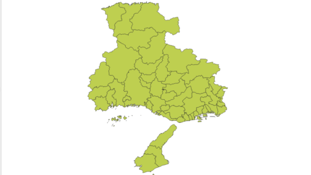
ひょうごのため池 #03【市区町界地図(Polygon)】

国土交通省の国土数値情報ダウンロードサービスから行政区域データ(ポリゴン)を取得して、QGISで地図を作成する。市区町別ポリゴン及びマルチポリゴンの融合(dissolve)の事例
2021.09.16 snusmumriken
Case StudyProcess
Search

Tag

Leaflet ため池 要監視ため池 兵庫県 防災重点農業用ため池 特定農業用ため池 GeoJSON Bootstrap select Google Maps Platform contextmenu ひょうご 交通事故 radio button 市区町界ポリゴン ラジオボタン contextmenuItem Google Maps JavaScript API geojsonlayer deck.gl マーカー marker mobile Google Map contextmenuItems オープンデータ polygon 指定避難所 指定緊急避難場所 複数マーカー カスタムマーカー Leaflet.pixiOverlay ポリゴン legend leaflet-markers-canvas scatterplotlayer javascript 市区町選択フォーム QGIS 市区町界 deckgl Split.js Leaflet.Sync 国土地理院 desktop L.circle Natural Earth overlaymaps 融合 オープンストリートマップ UN markerclusterer 地質図 markercluster 国土数値情報ダウンロードサービス tooltip opacitylayers choropleth map opacity General Assembly resolution

Category

  • Archives47
  • Case Study22
    • Practice18
      • Google Maps Platform8
      • Leaflet.js10
    • Process4
  • Outcomes17
  • Tips5
open data geographic utilize
Since 2021 © snusmumriken
    • Outcomes
    • Case Study
      • Process
      • Practice
        • Leaflet.js
        • Google Maps Platform
    • Tips
    • Archives
    • プライバシーポリシー
    • お問い合わせ
    • 思いつくまま
  • ホーム
  • トップ